Foundational Asset Condition Assessment Project progress update

13 March 2025
Murray Irrigation is making strong inroads into the ground, aerial and underwater survey work we are currently conducting across the network as part of the company's Foundational Asset Condition Assessment Project.
The below project
update outlines the progress
we have
made to date:
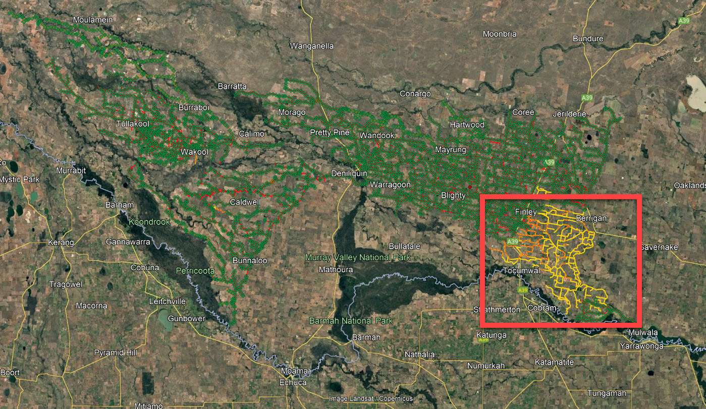
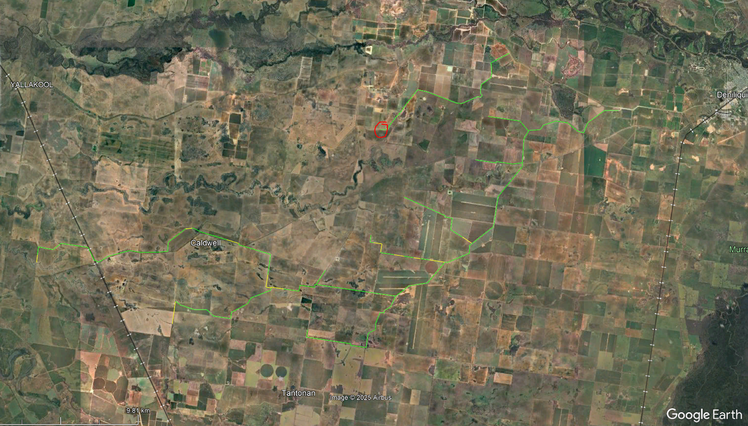
Ground Control Survey
The areas below in green have now had a ground control survey completed - this represents approximately 95% of the network.
With the yellow areas as depicted in the red square remaining, the survey crew is estimating to finish the control survey shortly.
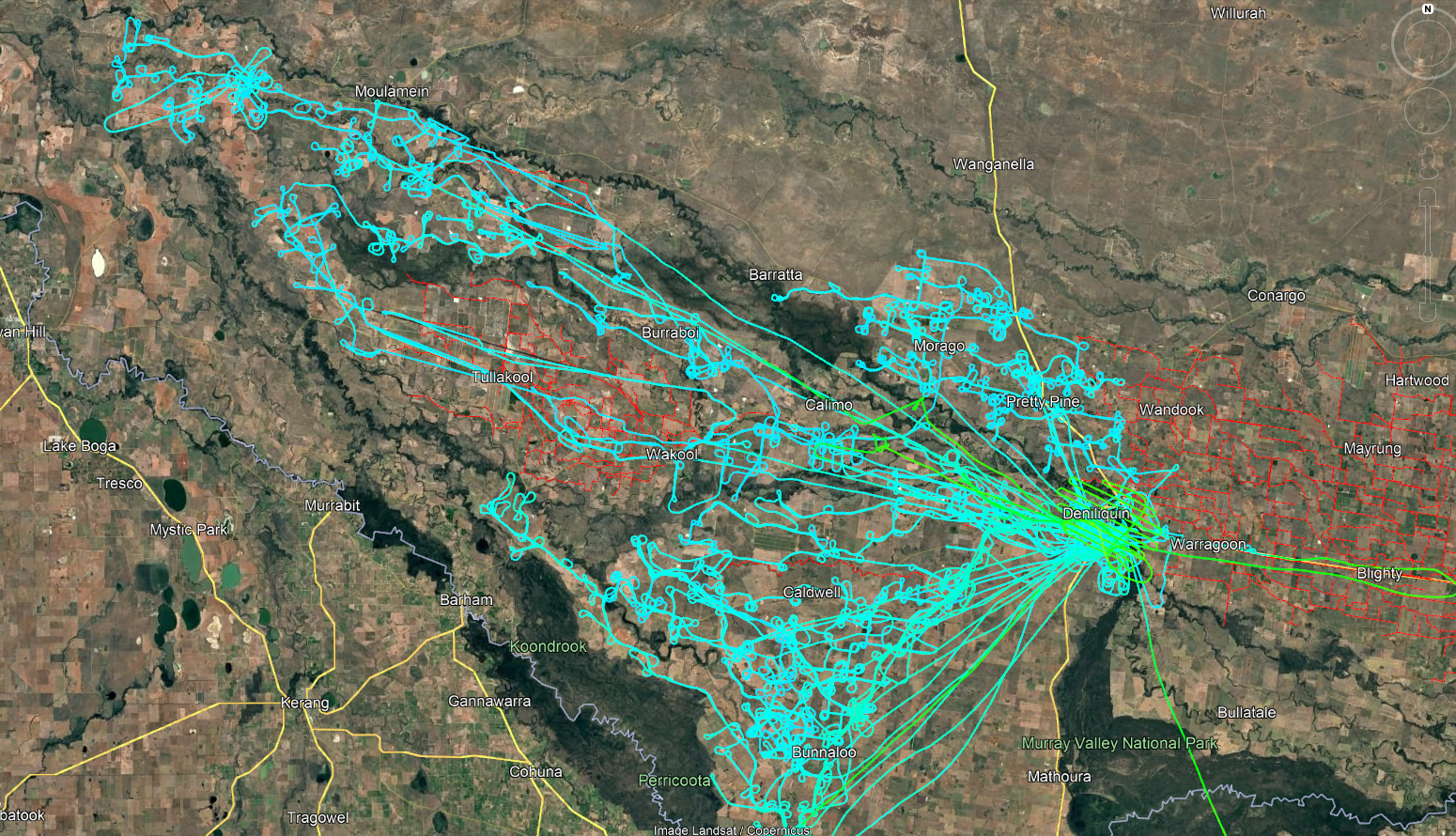
Aerial Survey
A second plane has now joined the Aerial team and the below in blue has now been flown, representing approximately 35% of the network.
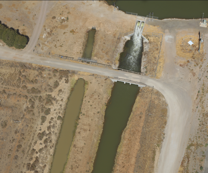
The Imagery being produced by the Photogrammetry from the Aerial Survey has to date come in better than we had expected, with some images coming in at approximately 1.8cm Ground Sampling Distance (GSD) (our aim is 2.5-3.5GSD). GSD refers to the amount of ground/surface area covered by a single image in flight.
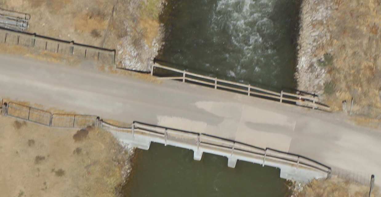
While at first glance, the image looks to be still from a great distance, due to the high resolution imagery, we can zoom in to focus on specific defects on assets.
The same image zoomed in can show the identifiable defects much clearer.
Bathymetric Survey
The Bathymetric survey has also now commenced, with approximately 5% of the network completed. This is depicted by the green lines on the image below.
Our operational needs and everyday challenges such as weeds, provide the Bathymetric survey with some unique challenges. We have undertaken multiple testing exercises and are constantly working with our contractors to review how this survey component is completed, to ensure, efficiency and effectiveness to provide the best possible results for the organisation.
Share this article:

About Us
Projects
Customer Resources
Community
News
Other
Legal
Copyright © 2023 Murray Irrigation Pty Ltd
site by mulcahymarketing.com.au